Science
El Niño Then and Now
Scientists are using a 35‑year satellite altimetry record to compare this year's El Niño with its strongest past occurrences.
By BubblesEdiy News Desk · Published · Updated
Automatically generated summary, written with AI assistance from reporting by NASA. Read the original at the source link in Credits below. Found an error? See our Corrections Policy.
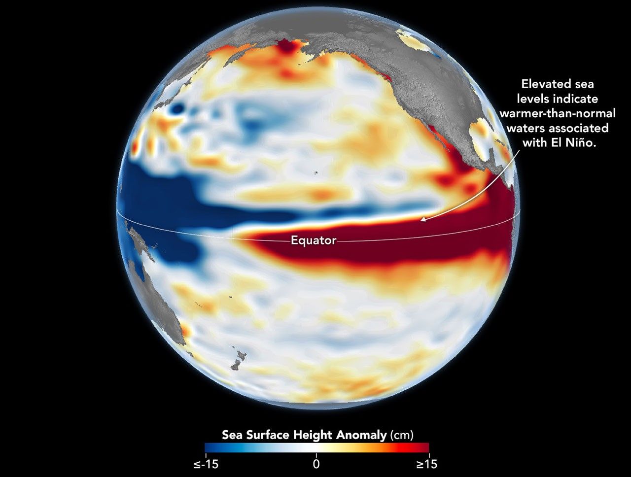
Image: Photo: NASA (from the original article) (licence page)
A continuous 35‑year record from satellite altimetry provides researchers with a consistent dataset for assessing sea‑level and ocean‑surface variations associated with El Niño events.
With this long‑term data, scientists can place the current El Niño in context alongside the most intense episodes on record, helping to gauge its relative strength and potential impacts.
Credits
- Image: Photo: NASA (from the original article) · licence page
- Source: NASA
- Written by BubblesEdiy News Desk, with AI assistance
About the Author
The BubblesEdiy News Desk byline is used for articles prepared and published by BubblesEdiy. Some articles are drafted with AI assistance and are labelled. Author profile
Related News

NASA’s Hubble Charts Path for Roman with Gravitational Lenses
Hubble has captured a series of gravitational‑lens images to aid future science with the Nancy Grace Roman Space Telescope.
BubblesEdiy News Desk ·
Read more
NASA Tests RS-25 Engine for Artemis Missions at Stennis Space Center
NASA fired an RS-25 engine for 500 seconds at Stennis Space Center in a test supporting Artemis missions.
BubblesEdiy News Desk ·
Read more
The Science of Healthy Habits: Why Small Changes Can Last
Research into behaviour, sleep and physical activity helps explain why realistic routines are often easier to maintain than dramatic lifestyle changes.
BubblesEdiy News Desk ·
Read more